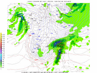
Its looking like a significant winter storm is on the way to the great lakes. Time frame for this storm looks to start late Monday and contiune into Wednesday. Significant snow is starting to look likely. With the heaviest coming Tuesday and Wednesday. As of right now I have one model spiting out possibly up to 20" of snow. Another one closer to a foot.
Above shown was just one weather model.. There is 2 others (Models) keeping this a touch south and cutting down on snowfall accumlations.
There will be changes to the forecast for sure. I'll blog some more about this tomorrow.
Kip


No comments:
Post a Comment