Tuesday, October 25, 2011

Hurricane Rina & Wet, Cooler Wx

Hurricane Rina

As of 5pm 10/25/11. Hurricane Rina was 275 miles SE of Cozumel Mexico and drifting to the west at 3 mph. Not going to be the greatest beach/swim up bar weather in Cancun and Cozumel over the next 24-36 hours. Mexican government has posted Hurricane Warnings for the region as a major hurricane is expected to move over the island of Cozumel. Here is a picture of Hurricane Rina below.


Hurricane Rina is expected to start to take a turn to the NW towards Cancun and Cozumel over the next 24 hours, then once it has pasted north of Cozumel models start to turn it to the Northeast. Over the last 24 hours spaghetti models which are a combo of all the hurricane models have shifted northward to South FLA. That's the bad news, the good news is I believe Rina will start to run out of gas as it will be sheared and it will be moving East/Northeast quickly. Below are the spaghetti models, the forecasted wind speeds and the official National Hurricane Center track.


Spaghetti Models.


Wind (Kt) Forecast. As you can see the winds drop by HR 102. This would be good if it starts tracking towards FLA.


Finally, the track from the National Hurricane Center in Miami FL. Taking Rina through the Florida straits by this weekend.


As for our weather in the great lakes, after some morning rain we got into some sunshine at my house. But it didn't last to long. But long enough to bump us into the low 60s. Warmer temps (even close to 70) along and south of the Ohio Broader. Today though was the last warm day as an area of low pressure will move across southern lower MI tonight and bring most of us a decent shot of some rainfall. Cold front is going to move to the south. and then stall. This will keep areas Flint /Lansing MI points south in the clouds and on/off rain through Thursday. North of there, High pressure will start to build in from the north and should start clearing things out and cooling things down. High pressure takes over Friday across the great lakes region and drys us out. Friday night with that high overhead we might have to watch out for a possible killing freeze away from the great lakes waters. Weekend right now is seasonable with a slight chance of rain on Sunday.

Saturday, February 19, 2011

Wintry Mess

A possible significant ice storm is headed for Lower Michigan. With significant snow possible also parts for Lower MI.

I'll knock out the snow part of this first. Up to 6 to 10" of snow is possible north of M 59 by Monday AM.

As for the freezing rain, Up to a 0.25 to 0.60 of ice is possible from a Mt. Clemens to Howell to just south of an East Lansing line southward to I94. South of I-94, about a .10 to .40 of an inch of ice is possible. It is possible that I think some rain sneaks into the southern counties of Michigan and cutting down on Ice accumulation.

Snow will move in after 12pm over the entire area. After sun set is when I think the snow starts changing over to sleet and freezing rain.

Travel will be messy starting Sunday Afternoon.

Kip.

Thursday, February 17, 2011

Back To Reality

I hope everyone enjoyed the day or two break from winter. Colder temperatures return for Friday along with windy conditions. At time winds may gust Friday afternoon up to 30mph. I do think we will stay below Wind Advisory status.


Wind direction/speed

Wind Gust

Speaking of winds. Tomorrow is not a good day to be out on Lake St. Clair. We will have whats known as the "off shore wind" wind coming out of the west may push the ice away from the shore. So unless you would like to go for the ride of your life, stay off the lake. Also I believe they now have a credit card machine in the rescue chopper.

Jumping to this weekend. Its not looking to bad as High Pressure builds into region. Temperatures seasonable, sorry not 50s. But highs will be in the 30s with lows in the teens and 20s.


Surface map Friday Night

Next week is starting to look very active. Will start things off with Monday. As a system will develop over the central plains and head towards the Great Lakes on a long wave pattern. First chance of precipitation comes Sunday. Still don't know what pre-cip type we are looking at, especially south of a Saginaw/Alma/Port Sanilac line. But just the heads up this could bring our snow shovels and snow blowers out of the garage once again.

GFS 12z run for 12z Monday (Monday AM)

Monday, February 14, 2011

February Thaw

There will be a little hick up Monday night and Tuesday with warming up. High pressure will build into the great lakes for Monday night and Tuesday. This will send temperatures into the teens Monday night and only into the 30s for Tuesday.

The warm up beings Wed and lasts until Fri. Depending how much snow we melt, Thursday and Friday's highs may make it into the 50s with ease. Don't expect the sun to much as well. As clouds and fog are going to be with us.

It's back to winter Saturday. Temperatures get back to winter averages. With temperatures for highs will be back in the 30s. And lows in the teens/20s.

Next week does get interesting. In fact the end of Feb. could get interesting. As a parade of storms come through the great lakes. First storm on tap will be Friday. This will be all rain, along with winds kicking up. Sunday night and Monday looks interesting as overrunning sets up. Which could led to a mix precipitation event. Stay tuned.

Wednesday, February 9, 2011

Light At The End Of The Tunnel?

I think there is some relief for next week. But we still have a few cold days to get through. Lows Wednesday night and Thursday Night will be around zero to 5 below with highs in the teens and 20s. Wind chill readings will range from 10 to 15 below Wed and Thu night.


Friday I think is when the slow improvements start. We will have a storm system (clipper type) move through the great lakes Saturday and then again on Monday. Both very week and I don't see much coming out of these systems. Highs on Fri will be in the low 20s, Saturday near 30 and Sun and Mon in the mid 30s.


Friday Night/Sat System... Not much to ride home about


And here is Monday's chance of snow... won't be much .


Tuesday and into the rest of next week shows a major change in the weather. And for those of you who hate cold weather. Its a change in the right direction. 7 days out though its kidda tough to pin down temperatures with the snowpack on the ground in the midwest. Right now for Tuesday and Wednesday, I will have temps for highs ranging in the 35 to 38. Possibly 40s.


Tuesday, February 1, 2011

Blizzard Warning!

Blizzard Warnings are in effect for lower MI south of a Harbor Beach/Bay City/Midland line and south. Right now I'm expecting well over a foot of snow with in the Blizzard Warning. Amounts tapper off north of there. Below is a map of all the warnings across the country. As you can see, lower Michigan is not the only one having to deal with this. Blizzard Warnings extend from Lower MI to Chicago to St. Louis and down into Oklahoma. Numerous Winter Storm warnings extend from the Southern Plains to the Northeast. I expect most of the Midwest including I94 from Detroit to Chicago, Ohio/Indiana Turnpikes, I-80 from Chicago to Des Monies. I 55 from Chicago to St.Louis to be Paralyzed.


Here is a map from the National Weather Service in Detroit. As you can see here amounts well over a foot. This map is just for SE MI. But all of lower Michigan Can expect amount well over a foot.


Time Line

Tuesday Morning through 4pm looks fine. Beyond the snow we got this morning. Tuesday will see a lull, especially through the late afternoon.

After 7pm Tuesday is when the weather really goes down hill and this is when all final storm preps (Food, Gas etc) need to be done completed. Snow after 8pm Tuesday may be going at an inch an hour. The heaviest snow will be from 7pm Tuesday to Noon Wednesday. I think the snow will be tapering off Wednesday afternoon. With the final snow totals above in the map. Below is the storm system location by Wednesday AM.


Winds are going to be a major issue starting Tuesday Night. This is the main reason why the National weather service issued the Blizzard Warning. You need to have winds at or above 35mph and visibilities below a quarter mile for 3 hours straight. I believe we will have winds around 30 to 40mph for most of the night Tuesday and the first part of the day Wednesday. This will create white out conditions and dangerous (hate to say this) possibly "life threating" travel. So do not travel if you do not have too.

If you must travel, please have a shovel, salt, blanket, cell phone and cell phone charger.

One last thing is starting Wednesday, Bitter cold air will flood into the midwest. I expect lows Thursday and Friday AM well below zero with highs only in the single digits.

TK

Saturday, January 29, 2011

Biggest Snow Of The Winter Season?

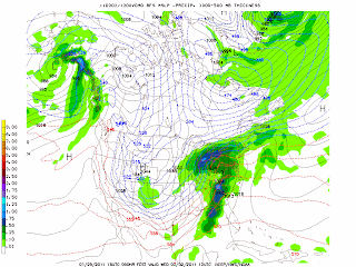
Its looking like a significant winter storm is on the way to the great lakes. Time frame for this storm looks to start late Monday and contiune into Wednesday. Significant snow is starting to look likely. With the heaviest coming Tuesday and Wednesday. As of right now I have one model spiting out possibly up to 20" of snow. Another one closer to a foot.


The biggest part of the storm looks to be right now overnight Tuesday on into Wednesday.
Above shown was just one weather model.. There is 2 others (Models) keeping this a touch south and cutting down on snowfall accumlations.
There will be changes to the forecast for sure. I'll blog some more about this tomorrow.
Kip