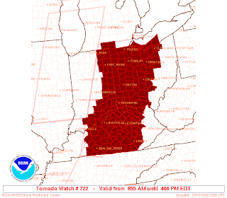
 Tornado Watch Until 4pm
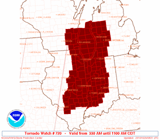
 Tornado Watch until 12 noon
 Severe Weather Outlook, High Risk for Metro Detroit
 Tornado % Chances, Hatched area indicates a chance of an EF-2 Tornado or higher with in a 25 mile pt.
 % Chances of damaging winds, Hatched area indicating Damaging winds greater than 70mph with in a 25 mile point.
 Damaging Squall line will push through the state of MI. Between 10am and 3pm. With in this squall line. Damaging winds in excess of 70mph are likely. A few storms may be capable of producing tornadoes. Some of which maybe LARGE and LONGTRACK.
Beyond 3pm. A High Wind Watch is in effect for all of Michigan through Late Tuesday Night. A High Wind Watch is in effect for the day Wednesday. Winds behind the cold front will be out of the west at 30-40mph with gusts up to 65mph.
Metro Detroit, East Lansing... You have about a couple more hrs to lock stuff down outside of bring stuff indoors.
No comments:
Post a Comment