A very powerful fall storm system that will rival the intensity of the Nov 1998 Storm and the storm that sunk the Edmund Fitzgerald in Lake Superior will take aim on the Great Lakes Region on Tuesday.
Out ahead of this storm system. A strong warm southerly flow will warm temperatures into the mid to upper 70s on Monday and Tuesday. On Tuesday, a strong cold front will push through the state. Severe weather is possible Tuesday afternoon.
Behind this storm system, winds will change from the south/southwest to the west or southwest. Sustained winds of around 50mph with wind gusts up to 70mph are possible on land areas. Near the open waters along the west shoreline and US-2 shoreline of Lake Michigan along with Lake Superior shore line could experience sustained winds of 60mph with gust up to 70-75mph Tuesday afternoon and Tuesday Night.
Please take Monday afternoon to lockdown and secure loose items such as patio furniture, trash cans and Halloween items. Failure to do so may result in objects becoming air-born, possibly resulting in car damage or human injury. Power outages are possible as well, along with tree damage in some areas. Don't approach down powerlines.
Updated blog on Monday Afternoon.
TK
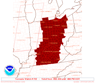
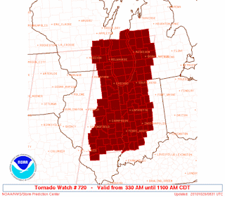
 New Tornado Watch is ineffect for all of Southern Michigan. Storms will be capable of producing Damaging Winds in excess of 80-90mph. Along with Tornadoes. Some Tornadoes maybe large and long track. If a Tornado Warning is issued for you're area. Do not grab the video camera! You more than likely will not see the tornado because it will be rained wraped. Go to you're basement, or interior room with out windows!


 Tornado % Chances, Hatched area indicates a chance of an EF-2 Tornado or higher with in a 25 mile pt.
 % Chances of damaging winds, Hatched area indicating Damaging winds greater than 70mph with in a 25 mile point.